Day 13: Browning - Chester
Distance: 105.0 miles
Having paid an extortionate sum for the motel we felt obliged to demolish the morning's continental breakfast buffet. Tropicana, chocolate milk, cereal packs, danishes, yoghurts, breakfast bagels, breakfast burritos - nothing survived the carnage that ensued.
Retired to our room feeling decidedly bloated - we felt it was time to quit when we almost wretched up the breakfast burritos we had just stuffed down. I'm hoping we got somewhere near our value for money.
Set off a bit late because we took advantage of the 11am check out time but we were swept onwards by the prevailing westerly winds to Cut Bank - hopefully these conditions were representative of how it would be the whole way across the plains of Montana and North Dakota.
Having coasted with a tailwind for most of the day, awful side winds almost blew us into the road just after Cut Bank but we soon turned East again and coasted the rest of the way to Chester.
Camped in the city park in Chester for free.
In June 2011 my friend, Dave Kennedy, and I are planning on fulfilling one of our life ambitions by cycling across North America. This is our story..
Sunday, 17 July 2011
WEDNESDAY 29 JUNE
Day 12: West Glacier - Browning
Distance: 71.8 miles
The climb up to Marias Pass was long but the gradient was pleasant. At the top we met a Korean family who had their pictures taken with us and Pete and his wife who gave us some mosquito spray for use once we were out of the mountains.
Great feeling getting to the top of Marias, the last big ascent until Maine. Even better as it was mostly downhill on average for the next several hundred miles to the Mississippi.
It started raining as we began the descent, lightly at first, before becoming torrential. The wind picked up into a harsh crosswind that drove the rain almost horizontally into our faces and bodies. The downhills were fast and dangerous given the driving the rain and small streams that began to form on the road surface.
To add to the misery of the rain Dave was chased a hundred or so metres down the road by an angry black dog.
By the time we reached Browning we were drenched and Dave was almost hypothermic. He had chosen not to don his waterproof gear for the descent and had taken a beating from the cold rain and relentless crosswinds. As a result, we booked ourselves into an overpriced motel ($123 a night!) and cashed in on some free hot cocoa. It was nice to be out of the cold and rain.
We wondered into Browning for food - probably one of the most run down areas we had experienced so far. A number of people had recommended we didn't stay there. It wasn't as bad as they made out but it wasn't particularly inspiring. (Browning is on the Blackfeet Indian Reservation - people's prejudice towards Native Americans had been clearly evident so far in Montana - sadly we experienced a lot of the stereotypes they had talked about that night).
TUESDAY 28 JUNE
Day 11: Whitefish - West Glacier
Distance: 50.7 miles
Had a lie in to take advantage of the 11am check out time before packing up.
Cycled to Columbia Falls and stayed on the 468 too far. Missed the turning onto another minor road and ended up on gravel roads in the middle of nowhere - great scenery though - saw parts of Glacier National Park we wouldn't have seen otherwise.
Rerouted to West Glacier, adding 22 miles to the day and confirmed that the Going-to-the-Sun road was closed. It was disappointing not to be able to cycle along the Going-to-the-Sun road but also cut out 100 miles and an ascent to over 6,000 feet. We were in two minds as to whether this was a blessing in disguise given the beating we took in the Rockies.
Arrived in a very well kept campsite with all the mod cons - free showers, wifi and a TV room. Got an early night for the 5,216 foot ascent up Marias Pass tomorrow.
REST DAY 2
Rest Day 2: Whitefish
After a well deserved lie in Dave shot into town to pick up a new front pannier rack from the local bike shop. Given the lack of panniers for sale in any of the three bike shops in Sandpoint the owner had a great selection of kit.
In the dim light of day the motel room looked like a scene from a cheap horror flick so we vacated post haste and spent the day doing laundry and blogging in Subway and Starbucks.
On our travels through Eastern Washington and Idaho we have been hearing reports from a number of people that the Road to the Sun in Glacier National Park is still closed due to heavy snowfall that hasn't melted yet. Provisional estimates for opening are as late as mid July.
Given this predicament we looked over the ACA maps to check the Marias Alternative and enquired further into the state of the roads - unfortunately, it doesn't look like we are going to be able to make it up the well known and reportedly beautiful Road to the Sun.
Before bed we worked out how long we would have left at the end of the trip on a makeshift Excel spreadsheet. Given the likely shorter detour over Marias Pass, our decision to take the SS Badger across Lake Michigan rather than skirting all the way round and our detour up to Montreal our route had changed considerably since its inception. We had also erred on the side of caution - overestimating distance, underestimating the distance we would cover each day and leaving several days at the end as a precaution.
At 70 miles per day we would have 16 rest days to take advantage of, at 80 mpd 22 and 90 mpd 29. Given the flat terrain in Montana and North Dakota 90 mpd could be far from unreasonable.
SUNDAY 26 JUNE
Day 10: Rexford - Whitefish
Distance: 78.7 miles
Woke up to a stunning view out over Lake Koocanusa and had a wonderfully bland breakfast of plain spaghetti and Ramen noodles. Packed up and smashed out 25 miles to Eureka over undulating terrain. Stopped off at Subway for lunch.
Spotted our first black bear running over the road behind us as we stopped for a water break. Dave shouted out and we both turned to see it shoot across from one side of the road and into the trees on the other. I think it might have smelt our peanut butter and chocolate protein bars.
We were chased by two friendly dogs down the road. Despite our pleas to go home they wouldn't and we continued with them in tow for about half a mile.
Roads on route to Whitefish were horrendous. Entire sections of tarmac had disintegrated leaving a dangerous jigsaw of potholes. In parts, 3 inch deep, several metre square sections of road, were missing. Perilous for cars, let alone bikes.
Arrived in Whitefish and shopped around for a cheap motel. Ended up paying for an absolute dive. I would say cheap and cheerful but in reality it was absolutely rotten. $58 for a double queen. It was still better than camping though. (Cheap Sleep was around $65 and a seemed a lot nicer if you're planning a motel stay in Whitefish).
Did a bit of shopping and got denied alcohol because a British passport isn't a valid form of ID. Only a third of Americans actually own a passport. Guess there's a 60% chance the guy at the counter didn't even know what the little red book I handed him was.
SATURDAY 25 JUNE
Day 9: Troy - Rexford
Distance: 68.9 miles
Woke up and had a bag of dry cereal between us before heading off down the road through Troy. Stopped at a lay by with a sign for Kootenai Falls and swinging bridge. Walked down and took some pictures.
Cycled on to Libby where we stopped for lunch at a Subway.
Followed the road around Lake Koocanusa - very scenic but some rolling hills made for a tiring day.
On the way around the Lake we started listening to some teach yourself Spanish CDs we had bought along for the trip. A good way to kill the 6-10 hours a day we were spending on the bikes.
At Libby Dam a car pulled over to warn us of a black bear and cubs they had seen by the side of the road in the direction we were heading, a potentially dangerous combination. We didn't see them but kept our eyes peeled staring into the greenery at the side of the road.
Not the best of days - a lot of rolling ups and downs had taken their toll by the time we had finished for the day. Dave was almost catatonic when we were chatting to the lady who ran the campground. However, we had ended up in a picturesque campsite at the edge of Lake Koocanusa.
Sunset over the lake was stunning as we set up camp and cooked our daily pasta load.
FRIDAY 24 JUNE
Day 8: Priest River - Troy
Distance: 87.5 miles (including a massive detour)
Woke up to another amazing fruit smoothie and breakfast, showered and packed up the bikes.
We met Cindi's Dad, an ex school teacher, and had a chat about schools and the education system in the States before we said our goodbyes to Rick and Cindi and thanked them for all their help. They really have gone out of their way to put us up and help us in any way they could. It was not only a godsend that Rick found us on the side of the road but it has been a pleasure to stay with them.
Before we left, Rick and Cindi made sure we were stocked up on food including our first peanut butter and jelly sandwiches and mac and cheese - American delicacies we had never experienced before. They also very kindly let Dave have a backpack to carry his gear from the front panniers until we can find a shop that sells front pannier racks - potentially Whitefish, three days ride from Priest River.
In Sandpoint we stopped for our PBJs - superb - and went into the bank to get out some more dollars.
While Dave was inside, Dean Karnazes look-a-like, Laith, came over to say hi. An avid cyclist himself, he had cycled around the States for 7 months when he was in his early 20s and offered to take us for a beer, invited us to a house party at his friend's after a local festival in Sandpoint and even had a set of front panniers he offered to fetch for Dave that he hadn't used for some time.
Instead, having had a rest day the day before, we chose to cycle in the wrong direction for half an hour and ended up having to reroute to make it back onto the correct route up several big hills! Dave will still need to find and purchase a set of front panniers and after all, who needs free beers, free equipment and to be the British guys cycling across America at an American house party.. In hindsight, a terrible decision but good dedication to the cause.
We got in late to the campsite and it started raining as we put up the tents. Ate macaroni and cheese in the dark and went to bed. We had to laugh at the situation or I think we'd have cried.
THURSDAY 23 JUNE
Rest Day: Priest River
Woke up around 8am to a wonderful breakfast of scrambled eggs, fresh orange slices and a blueberry smoothie, a great change from the usual porridge and pasta routine.
After breakfast we headed into Sandpoint with Rick and Cindi in search of a bike shop to repair the damaged spokes on Dave's front wheel and replace his front pannier rack. After visiting several local bike shops we decided on Sportsplus for the repairs as owner Bruce was adamant that he was the best.
No luck in all three of the bike shops with regards to the front pannier racks.
While we waited for the spokes to be fixed we took the opportunity to explore Sandpoint for a bit - a really pleasant wintersports resort town. We popped in to Starbucks and had some Burritos at a local café before heading back to collect the finished wheel. It was a good job and a quick turn around.
Earlier that day Rick had received a call informing him that an electricity company hadn't located before excavating for a new power line and had burst a water pipe on his land, severing the water supply to a local community. As a result, after lunch we picked up some pipes from the local hardware depot and headed over to the site.
We stood around for a bit with a crowd of the local community while Rick and two other workmen fixed the pipe. One of the guys showed us how to witch for underground water and electrical lines using a copper rod - surprisingly it worked!
Serviced the bikes and had a glass of wine with Rick and Cindi on the patio. Cindi prepared us a lovely steak dinner with asparagus and mashed potatoes.
After dinner we chatted for a while and went fishing off the dock at the end of the garden. It was an idyllic setting but as the fish weren't biting we soon gave up and went inside for a generous portion of ice cream instead.
A cup of sleepytime tea later we were ready for bed having had a wonderful and relaxing day with Rick and Cindi, our saviours and honorary American Aunty and Uncle!
Monday, 27 June 2011
WEDNESDAY 22 JUNE
Day 7: Chewalah - Priest River
Distance: 50.6 miles (shortcut over the Flowery Trail and Dave's accident)
Packed up camp and set off up Flowery Trail Road from Chewalah to Usk - interested and slightly hesitant as to where this shortcut would take us. It had been recommended by Bob and Herb, two cyclists we met a few days ago, and a number of people in Colville.
On the one hand, as far as distance was concerned, the detour saved us a few miles and it was great to get another Pass in before heading on to flatter pastures on the way through Idaho and Western Montana. However, the gradient was horrendous, much steeper than anything we had experienced so far. Not great after the 4 days of hard climbs we had just endured. (Think the Pass is more gradual coming from East to West). We plodded on and eventually made it to the top.
From the summit we shot down into Usk, had a celebratory ice cream, and shot off towards Newport.
Final destination for the day was Sandpoint but on the way Dave was caught off-guard by a bump in the road in Priest River which jarred his front pannier rack into his spokes causing it to wrap around the front wheel axle. He managed to keep control of the bike but came to an abrupt stop on the other side of the road.
We got off the road and had a look at the damage. It was too bad to cycle on or fix on the spot - the pannier rack had completely bent out of shape and all of the spokes on one side were damaged.
The nearest bike shop was in Sandpoint, 25 miles away, so we tried to hail passing pick-ups for about half an hour to get a lift to Sandpoint. No luck, most of them stopped but weren't going to Sandpoint.
In a moment of desperation Dave jumped up and started waving down an oncoming pick up. Luckily the driver, Rick, was happy to help us out and offered to take us in for the night and accompany us to Sandpoint the following morning to try and get the bikes fixed.
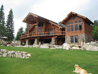
We pulled up to an amazing wooden house on the river where Rick introduced us to his wife Cindi and their dog Oliver. Cindi got us some dinner and we had a few beers and a good chat in the garden before having a well needed shower and a good nights sleep.
TUESDAY 21 JUNE
Day 6: Republic - Chewalah
Distance: 73.4 miles (Sherman Pass)
Woke up and Dave shot up the road in search of breakfast. Left for Sherman Pass, the final Pass on our journey over the Rockies. Really good climb - fast and steady with well organised breaks.
Reached the summit to find Rangers completing rock-fall prevention work on the cliffs bordering the road. Cars were being let through every 20 minutes. Chatted to Ranger, Brenda, for a bit then she let us through to take photos.
The work meant our side of the road was clear all the way down - no need to worry about passing cars.
We descended into Kettle Falls and Lake Roosevelt. The lake and surrounding area was very scenic. Would have liked to stay longer to explore.
Climbed out of the valley and over to Colville where we had our first junk food for a few days in celebration of finishing the Cascades. McDonald's strawberry milkshakes were incredible and well deserved - great times were had by all. (see picture below).
We met Chip, Ironman completer, outside of McDonald's and talked about some of the local triathlon and cycling events.
Headed from Colville down the 395 to Chewelah, a detour off the ACA Northern Tier Route recommended by Bob and Herb yesterday and a number of locals today as a shortcut. A steeper climb but a few miles shorter.
Rolled into town and met Matt Russell who directed us to the local town park and campsite, $10 again.
MONDAY 20 JUNE
Day 5: Riverside - Republic
Distance: 60.4 miles (up Wauconda Pass)
Woke up reasonably early and set about packing up camp, cooking breakfast and giving the bikes a well needed clean and general check-up. Met Linda and Jim at the campsite and had a chat about our respective travels and their love of football (soccer as they call it over here). They kindly let us borrow an adjustable spanner to make some adjustments to the bikes.
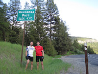
Made up the distance from Riverside to Tonasket and continued on up Wauconda Pass for most of the day. At our stop off point for lunch in Tonasket we bumped into Bob and Herb, two cyclists making the Transamerica journey from East to West. They had started in Connecticut and joined the Northern Tier through to Washington.
The passes on Route 20 in the Cascades are closed early in the year due to snow which makes crossing from East to West along the Northern Tier hard for those wishing to do so earlier in the year.
Bob is raising money and awareness for Ostomy Awareness - for more information on the condition, Bob's progress and how to donate please visit www.ostomy.org.
The climb up to Wauconda Pass was variable with intermittent steep and gradual uphill gradients. At the time it seemed never-ending.
When we eventually made it to Wauconda we had a nice surprise at Wauconda Cafe and store. Bob and Herb had told us about its perfect position just before the summit - a welcome break on the long and arduous trek up from Tonasket. Owners Neil and Maddie were friendly and helpful, catering especially for cyclists with their menu and food products. Well worth a visit.
We made it to the summit in good time and shot straight down into Republic and our campsite for the night. Ferry Port Fairground, good facilities and a steal at $10 a night.
Sherman Pass, the last of the four passes we encounter in the Cascades, lies in store for tomorrow.
SUNDAY 19 JUNE
Day 4: Twisp - Riverside
Distance: 46.0 miles (over Loup Loup Pass)
We were rudely awakened early this morning by a tick ticking sound and the intermittent spraying of water on our tents, a rather unusual alarm clock.
In the midst of the confusion we discovered that, whilst setting up in the pitch black, we'd had a bit of a nightmare and erected our tents beside the park sprinkler system. There wasn't much we could do so we tried to get back to sleep and eventually the sprinklers shut off.
In the morning we headed into Twisp to do some Laundry and have a spot of breakfast at one of the local cafés before setting off up Loup Loup pass. It was a good climb but a lot hotter, more consistent gradient-wise and shorter than Washington.
After a hot climb we were met by a treat at the top in the form of a Milky Way bar and met mountain biker Glen who worked for highway maintenance. He gave us some insight into the local roads and bike routes in the area.
Another great descent - steeper and faster than Washington.
Cycled over to Omak where we met Chay, ex-roadie for Ozzy Osbourne.., who doused us in copious amounts of mosquito spray and gave us some advice on camping. We found out why that night when we were eaten alive by thousands of bee sized mosquitos.
Ended up in Riverside rather than Taskonet due to setting off late but will make up the ground tomorrow on the way to Republic.
SATURDAY 18 JUNE
Day 3: Diablo - Twisp
Distance: 73.9 miles (up and down some serious hills)
Woke to the sound of the pitter patter of rain on our tents and had an enjoyable time packing up camp for the first time in the wet. The view out over the mountains made up for it and we were soon loaded up and ready to go.
We headed down to pick up some water from the toilets at the scenic viewpoint we had camped near the night before only to find a simple drop and no sink. Fortunately, while discussing our predicament (we would have to cycle a mile or two back down the mountain to the nearest campsite), we were overheard by a passing visitor. He kindly showed us to his truck where he opened a cooler full of ice cold water bottles he hadn't used on his trip. Literally a life saver.
It rained all day. All the way up the 30+ miles to the summit of the Rainy (adeptly named) and Washington passes. It certainly was an experience. Several hours of gradual climbs in full waterproof gear. At some points the rain had begun to form rivers down the road.
At around 5,000 feet the rain tapered off and snow began to appear at the side of the road, at points over a metre high on both sides, and the temperature began to drop significantly.
The final push up to the summit was breathtaking, in more than one way, leaving us in a state of euphoria when we finally reached the green sign indicating the peak of the Pass.
We stopped to change into some warmer clothes for the descent (ended up wearing socks over my completely drenched cycling gloves) and descended at speeds up to 41mph for 35 miles down to Mazama.
We arrived in Twisp at 9pm to find our target camp site was under maintenance. It had been a long day so we flagged down a passing car to ask for directions to a possible alternative. It was occupied by a few high school kids, including Farley, who offered to pick up his truck and take us to the local park where we found solace on a patch of grass behind the local swimming pool where we set up camp. Special thanks to Farley for going so far out of his way to help us find a place to stay.
ANACORTES AMERICAN
First local news story!
http://www.goanacortes.com/blog/blog_post/first_bikers_of_the_season
Thanks to Elaine Walker and the team at Anacortes American. If you ever get the chance to visit their lovely town please do, it really is great!
http://www.goanacortes.com/blog/blog_post/first_bikers_of_the_season
Thanks to Elaine Walker and the team at Anacortes American. If you ever get the chance to visit their lovely town please do, it really is great!
Thursday, 23 June 2011
FRIDAY 17 JUNE
Day 2: Rockport - Diablo
Distance: 35.4 miles (to the base of the Rockies)
Our first morning of camping brought the harsh realities of the trip to life. Sleeping in a tent was not only sweaty and uncomfortable but we also had to deal with waking up hungry, needing the toilet in the middle of the night and hayfever so bad I looked like a zombie out of 28 days later. However, we soon shrugged this off, packed up camp for the first time, and continued towards the ever-towering Rockies.
The scenery was amazing. Thick evergreen forests lined both sides of the road and the snow capped Rockies were a constant reminder of the hard days of ascent we had ahead. We came across some lung-bursting climbs but we anticipate these are just the tip of the proverbial iceberg.
We decided against pushing on over Washington Pass that night and having passed all of the campsites before the climb decided to try and find a place to camp on the side of the road. We ended up pushing through some trees next to a scenic viewpoint to find a small clearing completely secluded from the road and with one side facing out across the mountains. It really was spectacular.
Subscribe to:
Posts (Atom)